
Dirección General del Medio Natural, Comunidad Autónoma of Región de Murcia. Interreg Program.
2004-2005
UPCT and UMU
The objective of the present project is to develop guidelines for a ecological monitoring plan of the Ajauque-Rambla Salada Wetlands, a Protected Area,
A multidisciplinary study was carried out in which the following specific aspects were addressed: Vegetation and land use; Characteristics of soils and edaphic gradients; Hydrogeology; Aquatic invertebrates; Terrestrial invertebrates (arachnids); Aquatic vertebrates; Terrestrial vertebrates. Our research group focused on the edaphic study and soil-plants relationships.
Main researchers: José Álvarez Rogel (UPCT) and Rosa Gómez Cerezo (UMU)
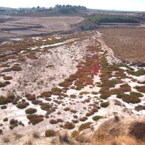
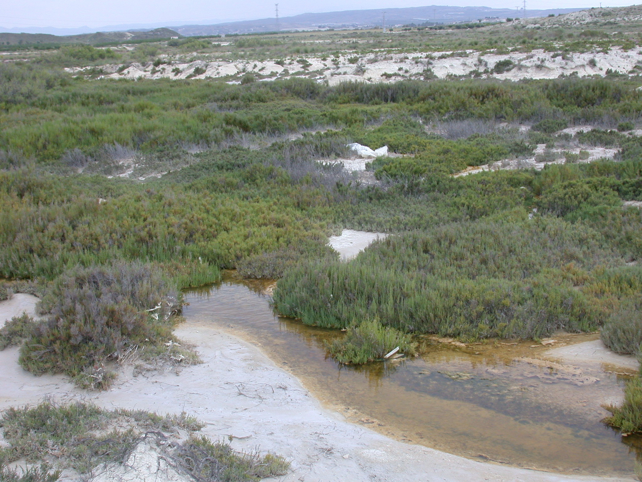
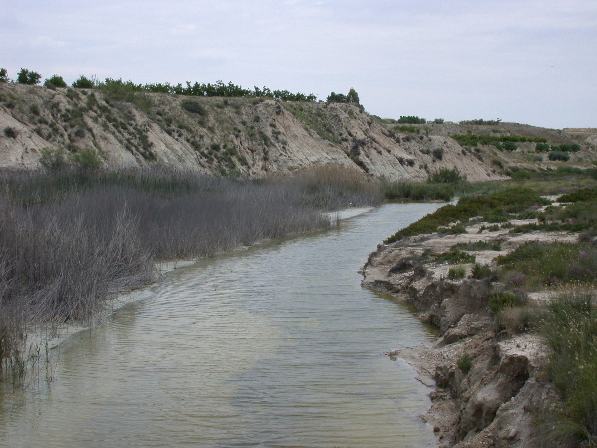
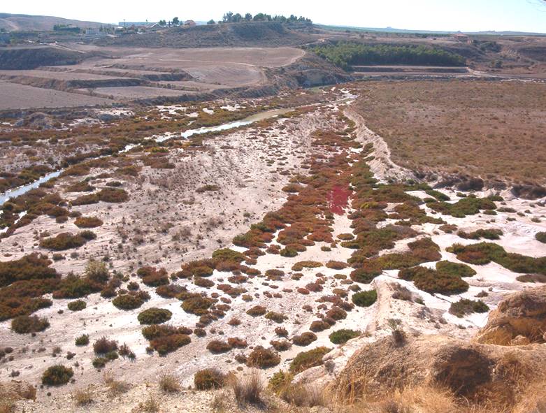
This study reports the soil–plant relationships within a protected landscape in semiarid SE Spain that includes salt
marshes and temporary streams and that is affected by agricultural water leaching. The main objective was to establish
a conceptual model in order to use vegetation as bioindicator of soil conditions.With this model, environmental
changes – based on the observation of vegetation – could be detectable, allowing the prevention of
environmental impacts and the improvement of the environmentalmanagement of the studied area. Eight sampling
stations with a total of 39 plots were established for the sampling of vegetation (floristic composition and
species abundance) and soil (moisture, pH, redox potential, electrical conductivity and soluble ions). Multivariate
analysis showed that vegetation was closely related to soil moisture and salinity. The soils colonised by steppe
grasses (dominated by Lygeum spartum) and halophilus and halonitrophilus shrubs (dominated by Suaeda vera
and Limonium spp.) were the driest (moisture b ~20%) and least saline (EC b ~30 dS m−1). Phragmites australis,
Sarcocornia fruticosa and Arthrocnemum macrostachyum dominated in the most saline and wettest soils.
P. australis reached maximum cover at EC values ~40 dS m−1 and soilmoisture ~30% and consistently appeared
on those soils with lower seasonal contrasts of moisture and salinity. Between 30 and 80 dS m−1 of soil salinity,
S. fruticosa reachedmaximum cover (~100%) while A. macrostachyum did not exceed ~80%. Outside this range of
salinity S. fruticosa declined (cover b10%), while the other species maintained cover N ~40%. In addition,
A. macrostachyum grew in soils with stronger seasonal changes of moisture and salinity. Based on the model
established, if an expansion of P. australis is detected, an increase in soil moisture and a decrease in soil salinity
during the year could be inferred. These changes could be due to an increased entry of effluents of fresh and/or
brackish water from agricultural areas. In turn, an increase in the cover of A.macrostachyumwould indicate higher
soil salinity, which could be a consequence of an increase in the evaporation rates (due to rising temperatures)
and a decrease in rainfall (predicted consequences of global warming). The expansion of S. fruticosa would be
favoured under relatively high soil salinity conditions (which limit P. australis expansion) jointly with high soil
moisture, without strong seasonal changes (which limit A. macrostachyum expansion). Our results support the
role of vegetation as bioindicator of disturbances and the use of soil–plant relationships models to improve the
environmental management of saline ecosystems.


Internal reports.
PAPER
González-Alcaraz, M.N., Jiménez-Cárceles, F.J., Álvarez, Y., Álvarez-Rogel, J. 2014. Gradients of soil salinity and moisture, and plants distribution, in a Mediterranean semiarid saline watershed: a model of soil-plant relationships for contributing to the management. Catena, 115: 150-158.